

Mapa správního rozdělení České republiky 1:1 000 000
| Informace o produktu | ||
|---|---|---|
 | Název | Mapa správního rozdělení České republiky 1:1 000 000 |
| Obchodní kód | 63244 | |
| Výdejní jednotka | ČR | |
| Cena za jednotku | Dle Vyhlášky č. 31/1995 Sb. | |
| Výdejní formáty | TISK | |
| Souřadnicové systémy | S-JTSK / Krovak East North | |
| Distribuce | 
| |
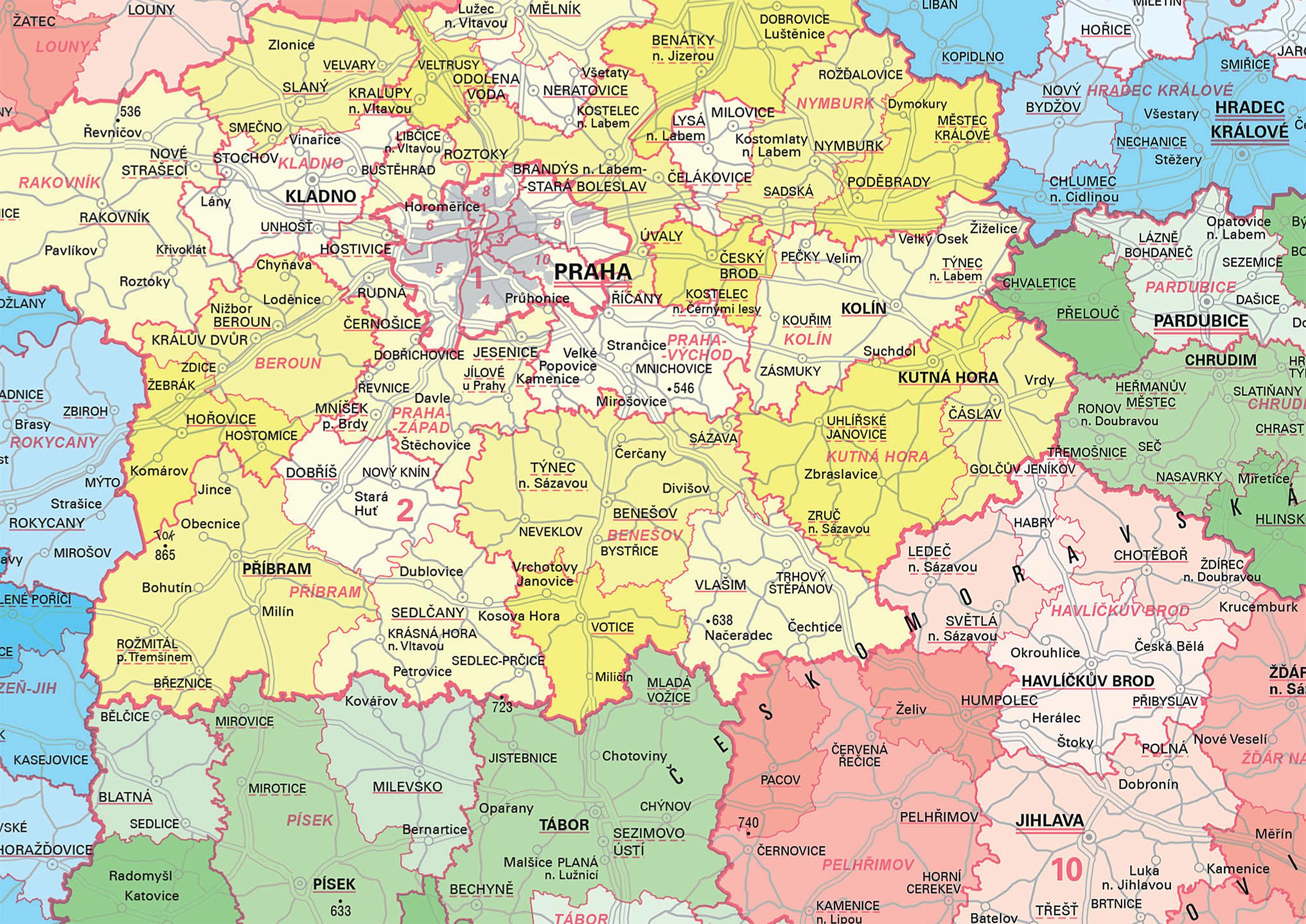
| Popis produktu | Česká republika – Mapa správního rozdělení 1:1 000 000 (MSR 1M) je vyhotovena na podkladu mapy České republiky 1:1 000 000 a obsahově navazuje na mapu „Česká republika – Mapa správního rozdělení 1:500 000“. Zobrazuje celé území České republiky na jednom mapovém listě, tj. plochu 78886 km2. Rozměry papíru jsou 53,5 x 35 cm, rozměry mapového pole jsou 49,5 x 31 cm. MSR 1M obsahuje hranice, sídla, silniční síť, popis, barevné výplně ploch okresů a vysvětlivky k mapě. Hranice jsou rozlišeny na státní, krajské, okresní a správních obvodů obcí s rozšířenou působností. Popis zahrnuje názvy sídel s rozlišením na hlavní město České republiky (ČR), statutární města, krajská a okresní města, města, obce a části obcí, název a měřítko mapy s tirážními údaji, údaje grafického měřítka a textovou část vysvětlivek. Barevné výplně odlišují území jednotlivých krajů; správní obvody obcí s rozšířenou působností jsou vzájemně odlišeny odstíny barvy příslušného kraje. Zadní strana mapy obsahuje textové informace o správním rozdělení ČR a vybraných statutárních měst. | |
| Aktualizační cyklus - stav aktualizace | Poslední vydání mapy je z roku 2021. | |
| Podmínky přístupu a použití | Dle Vyhlášky č. 31/1995 Sb. | |
| Prohlížení dat | ||
| Stahování dat | ||
| Kontakt - informace o produktu | Český úřad zeměměřický a katastrální, e-mail: premysl.jindrak@cuzk.cz | |
Poslední aktualizace produktu:
2021-04-23
2021-04-23
Poslední aktualizace/revize informací:
2023-06-30
2023-06-30
 RSS 2.0 Geoportál ČÚZK