

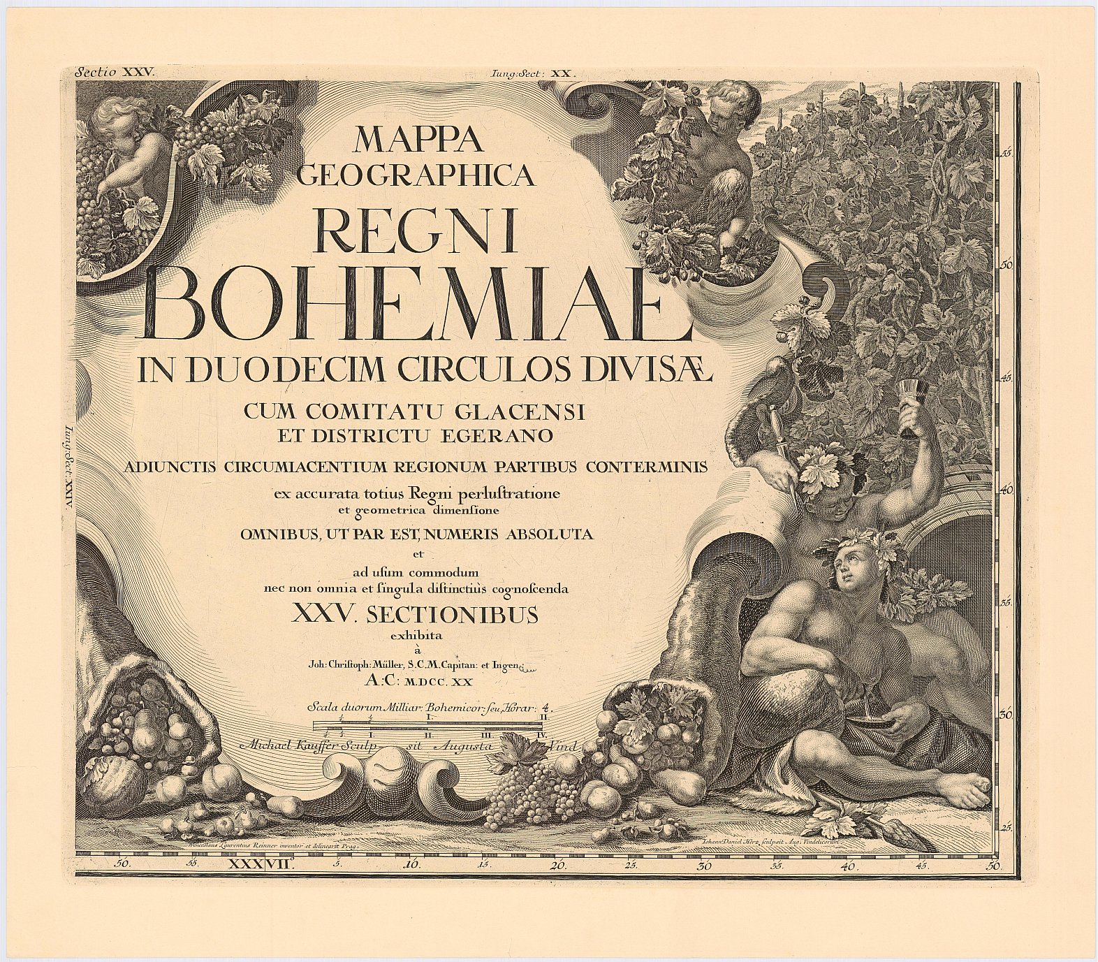
Müllerova mapa Čech z roku 1720
| Informace o produktu | ||
|---|---|---|
 | Název | Müllerova mapa Čech z roku 1720 |
| Obchodní kód | 632788 | |
| Výdejní jednotka | Čechy | |
| Cena za jednotku | Dle Vyhlášky č. 31/1995 Sb. | |
| Výdejní formáty | TISK | |
| Souřadnicové systémy | ||
| Distribuce | 
| |
| Popis produktu | Müllerova mapa Čech z roku 1720 a přilehlého pohraničí. Autor Johann Christoph Müller. Je orientována k severu. Největší stará mapa Čech. Zobrazovala celkem 12 495 sídel, vodstvo, porosty, reliéf, cesty, hranice a další skutečnosti. Názvosloví bylo převážně německé, částečně české. Popisy byly latinské a německé. Byla vytištěna na 25 mapových listech. V rozích byla bohatě vyzdobena pohledem na Prahu a alegoriemi. | |
| Aktualizační cyklus - stav aktualizace | Neaktualizuje se, jde o kopii archiválie. | |
| Podmínky přístupu a použití | Dle Vyhlášky č. 31/1995 Sb. | |
| Prohlížení dat | ||
| Stahování dat | ||
| Kontakt - informace o produktu | Český úřad zeměměřický a katastrální, e-mail: prodejna.map.praha@cuzk.gov.cz | |
Poslední aktualizace produktu:
1720-01-01
1720-01-01
Poslední aktualizace/revize informací:
2025-03-06
2025-03-06
 RSS 2.0 Geoportál ČÚZK