

Prohlížecí služba WMS - Data50
| Informace o produktu | ||
|---|---|---|
| Název | Prohlížecí služba WMS - Data50 | |
| Obchodní kód | Obchodní kód není stanoven | |
| Výdejní jednotka | Výdejní jednotka není stanovena | |
| Cena za jednotku | ||
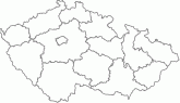
| Popis produktu | Prohlížecí služba WMS-Data50 je poskytována jako veřejná prohlížecí služba nad daty topografické databáze České republiky Data50. Kartografická vizualizace objektů vychází z podoby Základní mapy 1:50 000. Služba může být využita jako vektorová podkladová mapa ČR pro měřítka od cca 1:60 000 do cca 1:25 000. Služba splňuje standard OGC WMS 1.1.1. a 1.3.0. | |
| Vlastnosti služby | ||
| Lokalizace služby | https://ags.cuzk.cz/arcgis/services/DATA50/MapServer/WmsServer? | |
| Datové sady poskytované službou |
Poskytovaná data
| |
| Omezení a podmínky přístupu a použití | Zásady užívání dat a služeb ZÚ | |
| Prohlížení služby ve veřejném klientu |
Spustit službu | |
| Kontakt | Český úřad zeměměřický a katastrální, Srovnal Pavel, Mgr. , tel: +420 585 552 410 , e-mail: pavel.srovnal@cuzk.cz | |
Poslední aktualizace produktu:
2024-04-17
2024-04-17
Poslední aktualizace informací:
2024-04-18
2024-04-18
 RSS 2.0 Geoportál ČÚZK