

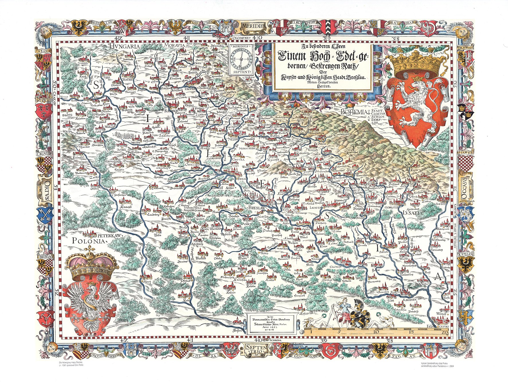
Hellwig's map of Silesia, year 1561
| Product information | ||
|---|---|---|
 | Name | Hellwig's map of Silesia, year 1561 |
| Commercial code | 632784 | |
| Export unit | Silesia | |
| Unit price | According to Regulation No 31/1995 Sb. | |
| Export formats | TISK | |
| Coordinate systems | ||
| Distribution | 
| |
| Product description | The map captures a territory of Silesia, Glatz, most of the Upper and Lower Lusatia and the adjacent border region, it is dated to 1561. Martin Helwig is an author. It is oriented to the south. 327 settlements, hydrography, vegetation and relief is shown on the map. German terminology is used, descriptions are in Latin and German. It was a model for Fabricius map of Moravia. It has a rich heraldic decoration. It includes the oldest known record of the legendary Krakonoš. It was very instructive, it should serve also for the educational purposes. | |
| Update cycle - update state | It is not a subject of update, it is a preserved map copy. | |
| Conditions applying to access and use | According to Regulation No 31/1995 Sb. | |
| View data | ||
| Data download | ||
| Contact - product information | Czech Office for Surveying, Mapping and Cadastre, e-mail: prodejna.map.praha@cuzk.cz | |
Product last update:
1561-01-01
1561-01-01
Information last update:
2023-06-30
2023-06-30
 RSS 2.0 Geoportal ČÚZK