

ZABAGED® - Altimetry - DMR 5G. Digital Terrain Model of the Czech Republic of the 5th generation (DMR 5G) in S-JTSK, Bpv
| Product information | ||
|---|---|---|
 | Name | ZABAGED® - Altimetry - DMR 5G. Digital Terrain Model of the Czech Republic of the 5th generation (DMR 5G) in S-JTSK, Bpv |
| Commercial code | 64111 | |
| Export unit | SM 5 map sheet | |
| Unit price | No charges | |
| Export formats | LAZ | |
| Coordinate systems | S-JTSK / Krovak East North, Výškový systém baltský - po vyrovnání | |
| Distribution | 


| |
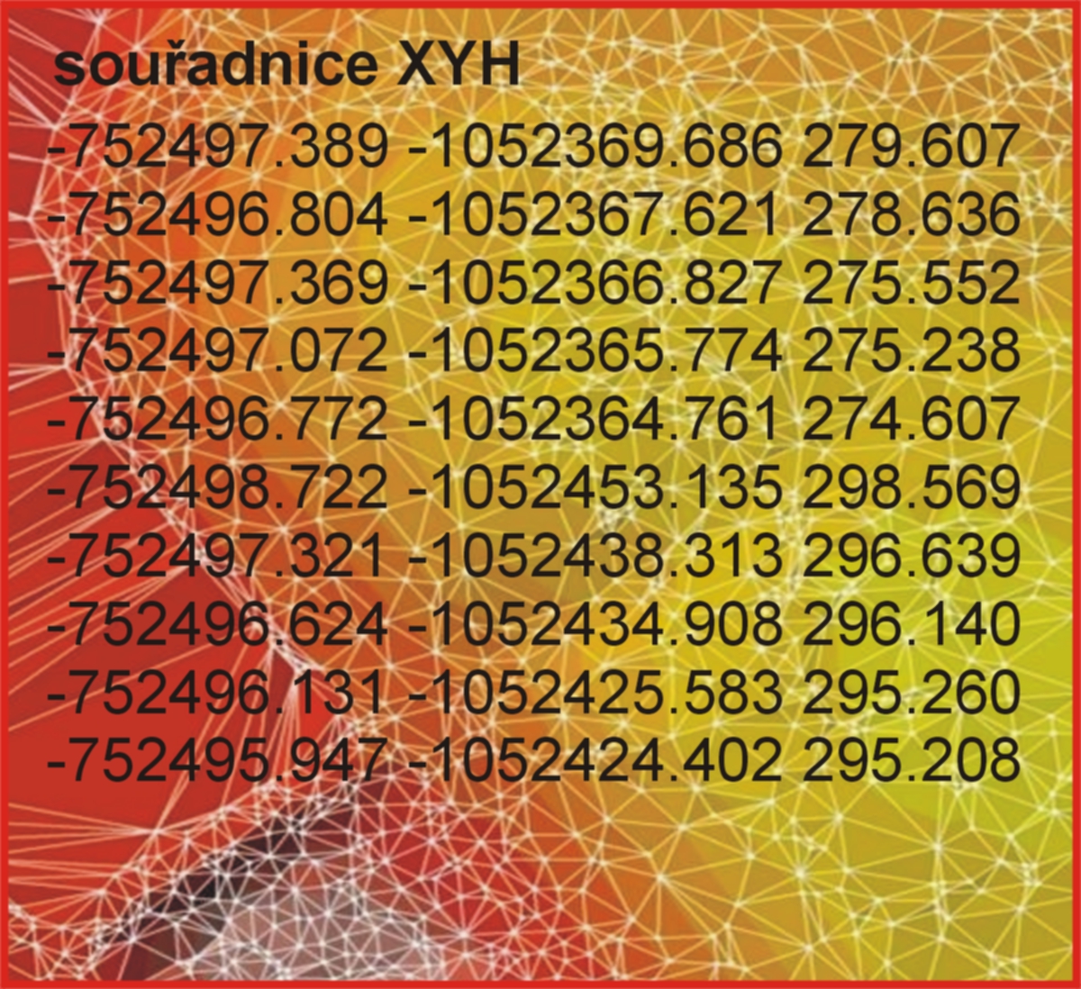
| Product description | The 5th generation digital relief model of the Czech Republic (DMR 5G) represents a representation of the natural or human-modified earth's surface in digital form in the form of heights of discrete points in an irregular triangular network (TIN) of points with coordinates X,Y,H, where H represents the height above sea level in the Balt height reference system after leveling (Bpv) with a complete mean height error of 0.18 m in exposed terrain and 0.3 m in forested terrain. The model was created from data acquired by the method of airborne laser scanning of the elevation of the territory of the Czech Republic in the years 2009 to 2013. It was completed as of 30 June 2016 for the entire territory of the Czech Republic. DMR 5G is intended for the analysis of terrain conditions of a local nature and extent, e.g. in the design of land adjustments, planning and design of transport, water management and building structures, modeling of natural phenomena of a local nature, etc. DMR 5G is a basic source database for the creation of contour lines intended for large-scale maps and computer visualization of elevation in territorially oriented information systems of high level of detail. | |
| Update cycle - update status | DMR 5G je Zeměměřickým úřadem průběžně verifikován v souvislosti s plošnou aktualizací Základní báze geografických dat České republiky a aktualizován metodami digitální stereofotogrammetrie a na vybraných územích i metodou leteckého laserového skenování. Verification status Update state | |
| Conditions applying to access and use | No charges Creative Commons CC BY 4.0 License According to Regulation No 31/1995 Sb. | |
| View data |
Web map application Služba WMS | |
| Data download |
Atom service Export of a current extent Pre-defined files download - selection above the map | |
| Contact - product information | Land Survey Office, e-mail: ZU-obchod@cuzk.gov.cz | |
Product last update:
2025-01-09
2025-01-09
Information last update:
2025-06-25
2025-06-25
 RSS 2.0 Geoportal ČÚZK