

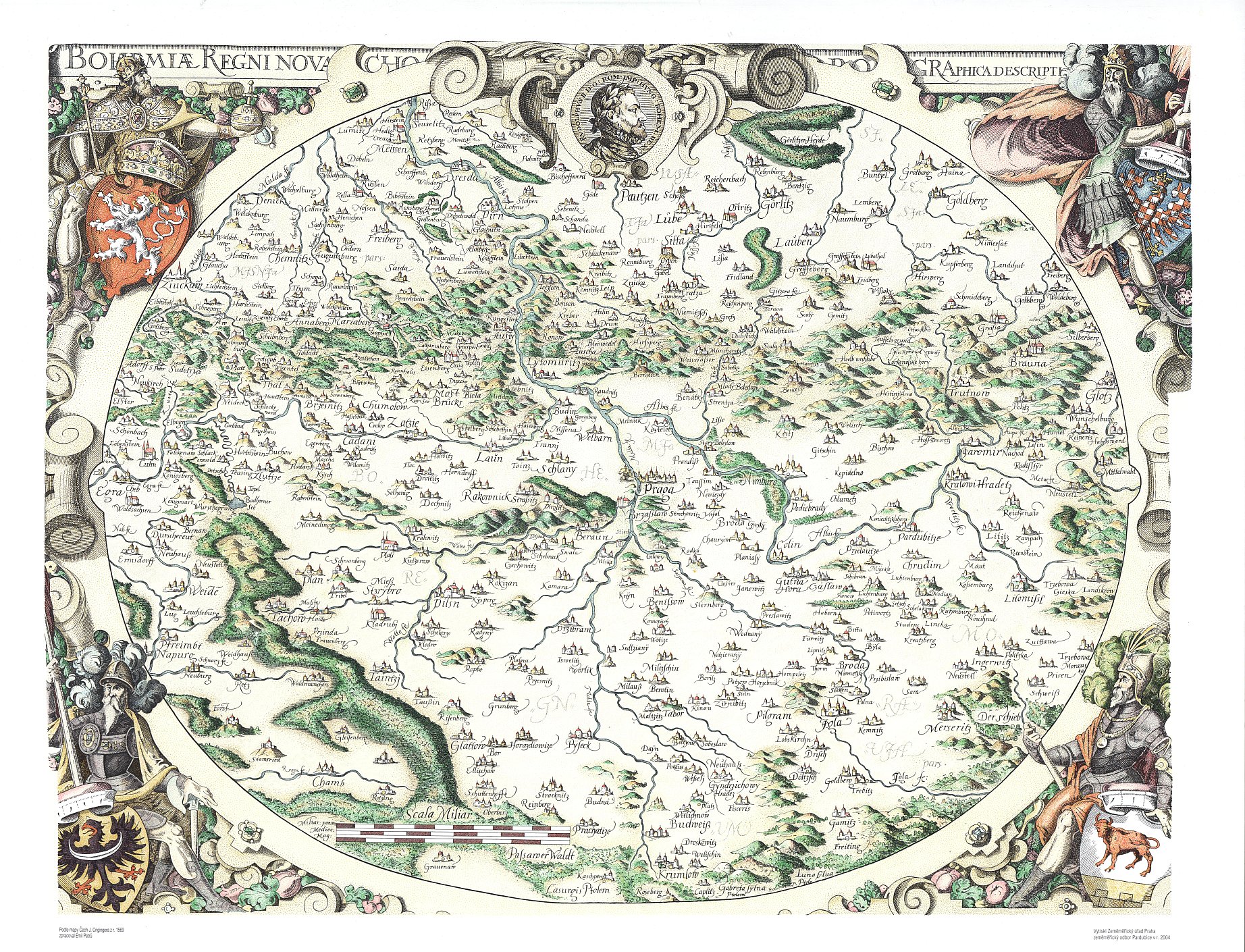
Crigingerova mapa Čech z roku 1568
| Informace o produktu | ||
|---|---|---|
 | Název | Crigingerova mapa Čech z roku 1568 |
| Obchodní kód | 632782 | |
| Výdejní jednotka | Čechy | |
| Cena za jednotku | Dle Vyhlášky č. 31/1995 Sb. | |
| Výdejní formáty | TISK | |
| Souřadnicové systémy | ||
| Distribuce | 
| |
| Popis produktu | Mapa Čech a přilehlého pohraničí z roku 1568. Autor Johann Criginger. Je orientována k severu. Zobrazuje 292 sídel, vodstvo, porosty, reliéf. Názvosloví je české a německé, někdy zkomolené, další popisy latinské. Mapa je ozdobena znaky Čech, Lužice, Moravy a Slezska a portrétem císaře Rudolfa II. | |
| Aktualizační cyklus - stav aktualizace | Neaktualizuje se, jde o kopii archiválie. | |
| Podmínky přístupu a použití | Dle Vyhlášky č. 31/1995 Sb. | |
| Prohlížení dat | ||
| Stahování dat | ||
| Kontakt - informace o produktu | Český úřad zeměměřický a katastrální, e-mail: prodejna.map.praha@cuzk.cz | |
Poslední aktualizace produktu:
1568-01-01
1568-01-01
Poslední aktualizace/revize informací:
2023-06-30
2023-06-30
 RSS 2.0 Geoportál ČÚZK